We can provide a complete tailored solution to streamline your project saving you time, money and risk.
Cadastral Surveying (Pecah Bahagian , Pecah Sempadan)
Cadastral surveying is the discipline of land surveying that relates to the laws of land ownership and the definition of property boundaries. All survey work that involved in cadastral surveying will follow all the regulations based on National Land Code 1965 procedures and Strata Title Act 1985 and also all regulations that have been stated by the Department of Survey and Mapping Malaysia (JUPEM).
Topography survey are used for measurement of topographic, contour, locates all surface features of a property, and depicts all natural features that includes the height and elevation of the ground for our client. Topographic survey used for ground control point survey, leveling, topographic detail survey, level points for modeling and terrain profile and acquisition of topographic data.
Engineering survey are required for the design and construction of civil engineering projects such as roads, railways, bridges, tunnels, landfill cells, landfill caps, mining infrastructure, pipelines and quarry infrastructure. At Jurukur Mahabob & Co Sdn Bhd, we provide to client the best possible services.
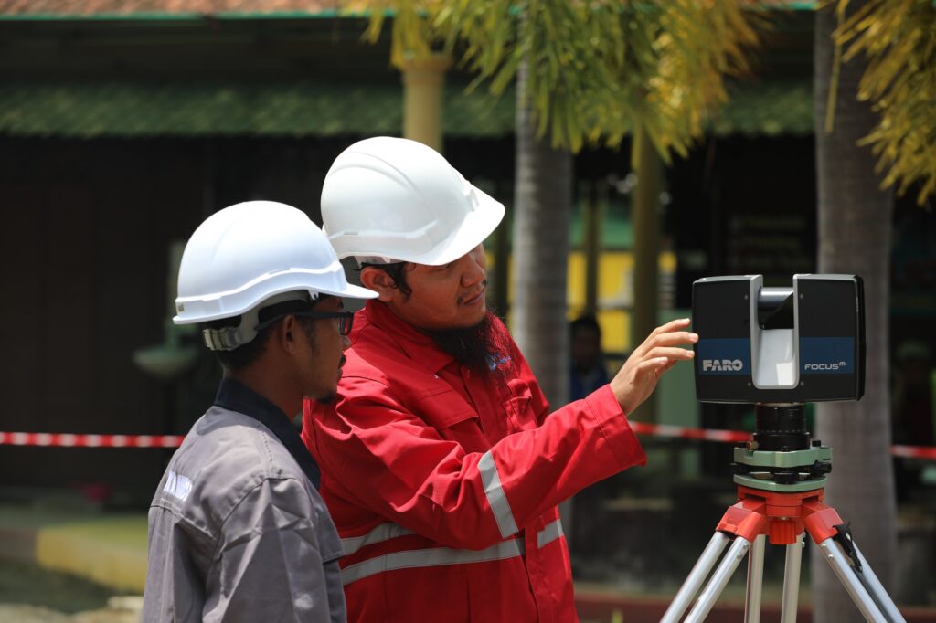
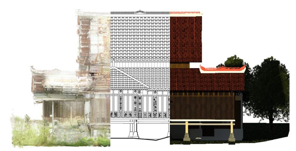
Terrestrial Laser Scanning where we provide services that can give an accurate 3D data in time with cost effective time. The Laser scanning gives a 3D point clouds that can capture objects surface. In other words, the 3D laser scanner used to capture physical object into their exact size and shape.
As-Built Survey is a survey conducted and shown on a drawing prepared and sealed by a Registered Surveyor. We deliver As-Built Surveys no matter the scale of the project. Our As-Built Surveys allow capturing the information of existing buildings and structures due to the accuracy of our high-standard 3D Laser scanning equipment.
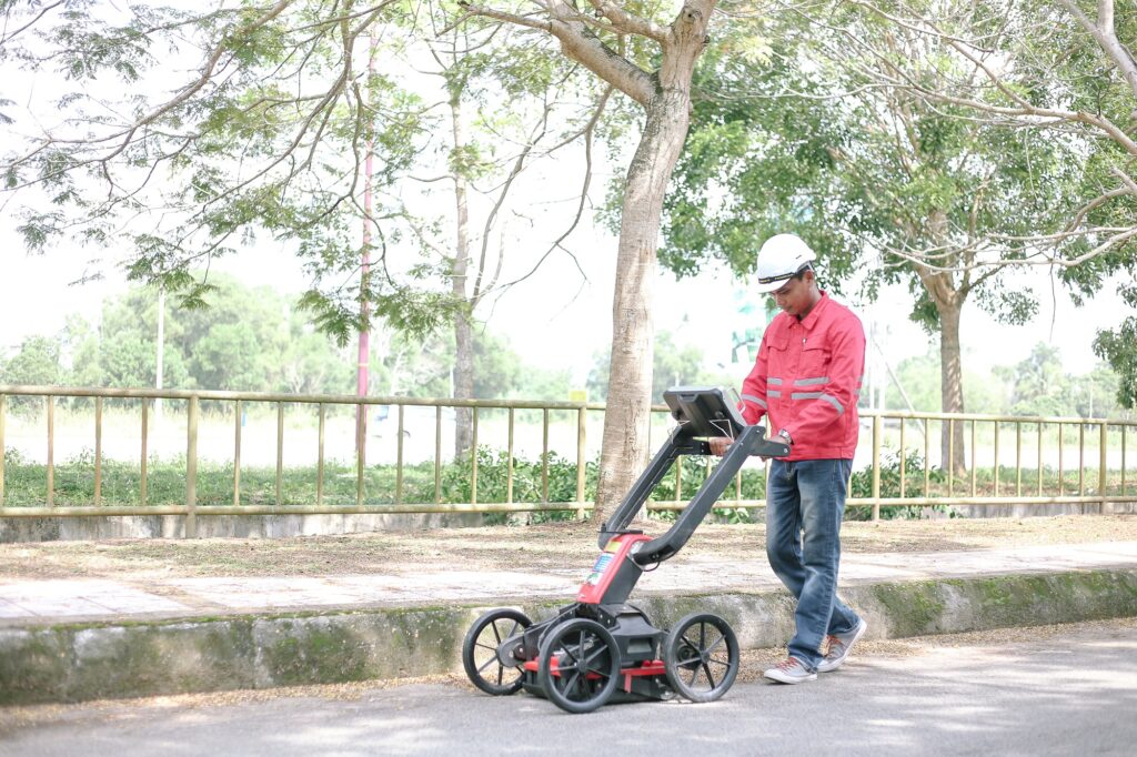
We provide the utility plan that defines the detection of underground utilities. The utilities that can be detected underground such as pipes and cables. We are using the EML and GPR that only can detect the pipes and power cables not includes fiber optic cables.
Unmanned Aerial System (UAS) used for mapping. We provide services for mapping, monitoring, and observation as it can capture large areas for survey data. Also the using of UAV and drone gives short time period of working time. It also reduces working time and it gives a high accuracy surveying of data. The application of this both instruments can be used for purpose of large area mapping and observation.
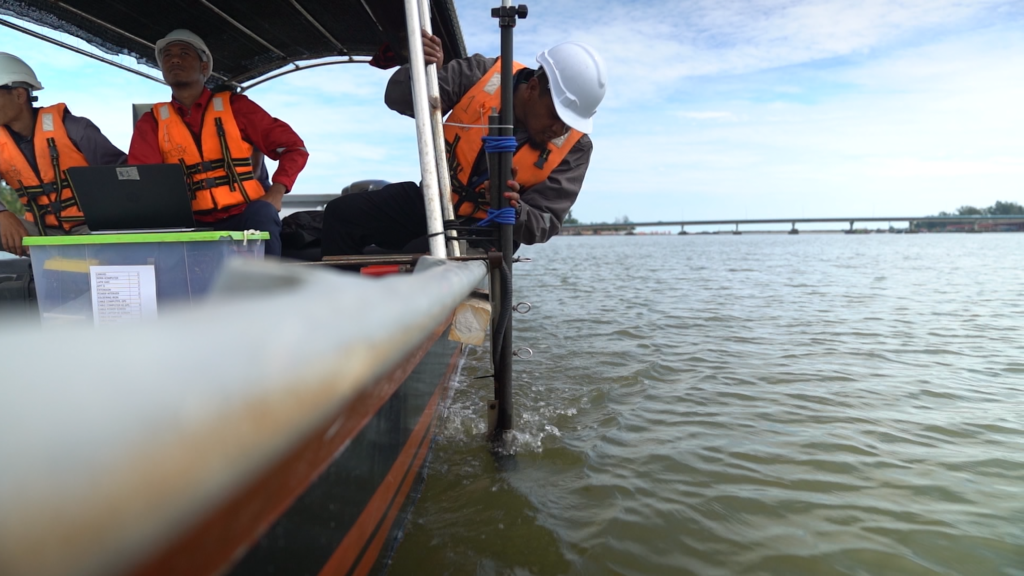
Hydrographic survey involves measuring the terrain of lake, dam or ocean floors to determine the bed profile. At Jurukur Mahabob & Co Sdn Bhd, we provide professional hydrographic work, bathymetric and professional hydrographer. Hydrographic project will provide the undersea surface contour. Our survey work selected based on client needed such as the water depth, seabed condition and others.
Geographical information system is a computer system that analyses and displays geographically referenced information. At Jurukur Mahabob & Co. Sdn Bhd, we offer solutions to your Spatial Data needs from specification, data acquisition, data analysis, and data management. We also offer the visualization of geographic data. We also used GIS for purpose of collecting data for client needed to built a new GIS system database.